
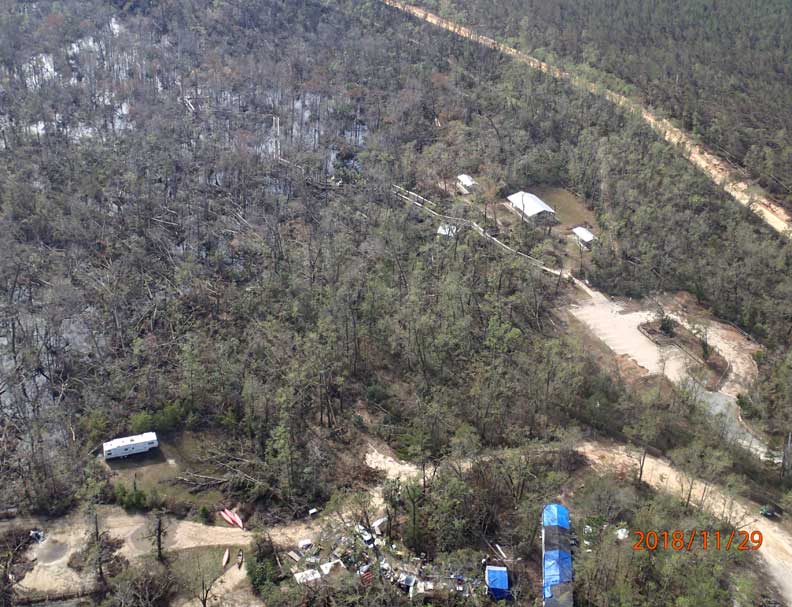
Dec. 27, 2018 – HAVANA – The Northwest Florida Water Management District launched a web application to help the public view the agency’s damage assessment from Hurricane Michael.
The interactive application features an adjustable Google Earth view map showing the impacted areas from Hurricane Michael, including aerial photographs of impacted rivers, streams, and roadways. It also shows updated graphs of selected rivers that illustrate changes in water levels associated with debris from the storm.
“We live firsthand with the damages inflicted by Hurricane Michael each and every day and with challenges that lie ahead for northwest Florida,” District Governing Board chairman George Roberts said. “That is why I am so pleased to see the launch of this important tool to help us grapple with the scope of the ongoing impacts, as well as track our path to recovery and normalcy.”
Users can adjust the map to view before and after photos of impacted lands with layers available to focus on agricultural lands, the District’s recreation sites, or trails and roads. The District will update the map to show progress on recovery efforts.
A photo submission tool is also available to report flooding issues related to Hurricane Michael and rain events following the storm. The public is encouraged to upload photographs to help show the storm-related flooding issues in northwest Florida.
The link for the Mapping Tool is located here: https://nwfwmd.maps.arcgis.com/apps/webappviewer/index.html?id=7666fbd775264133a16deebeeafab87b The link for the Photo Submission Tool is located here: https://arcg.is/1rzbTW