
Northwest Florida offers and abundance of spectacular recreation opportunities. Beautiful beaches, crystal clear springs, and what seem as though never-ending hiking trails, there are natural areas to please any outdoor enthusiast. One such area off the beaten path is Eglin Air Force Base Reservation.
Spanning across Santa Rosa, Okaloosa, and Walton counties, Eglin offers 250,000 acres conditionally open to the public for hiking, biking, camping, fishing, hunting, and paddling. However, you must acquire a recreation permit to enjoy the many opportunities. To purchase, go to https://eglin.isportsman.net. You may also call Jackson Guard at (850) 882-4165 or (850) 882-4166 for additional information.
Eglin offers more than 100 miles of paddling trails on Turkey Creek, Boiling Creek, Basin Creek, East Bay River, Rocky Creek, Titi Creek, and the Shoal River. Click here to learn more about the offerings.
Paddle trips on Eglin should be planned in advance. Accessibility of Eglin waterways will vary depending on daily base closures. Visitors should always remember to check the public access map PAM when planning a trip to Eglin. Areas of Eglin are subject to closure without advanced notice to the public.
Below are two extraordinary paddling opportunities along seepage spring clear waters. Bring some friends and shuttle your own vessels as there are no rental facilities in the area.
Boiling creek
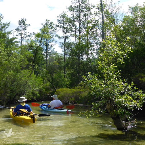
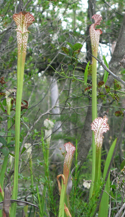
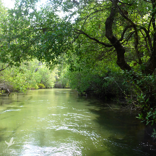
Located off of Hwy. 87, south of Milton and north of Navarre, Boiling Creek is lined with towering old-growth cypress trees, and an abundance of flora, including water lilies, pitcher plants, and spatterdocks. The water is clear, and colorful underwater grasses rippling below can be easily viewed as you meander down the seepage spring creek.
Boiling Creek is approximately 25 feet wide for most of the paddle, and common sights are turtles, ospreys, hawks and other birds, such as woodpeckers, great blue herons, and kingfishers. There are a few sloughs you can explore that offer a closer look at the blooming wildflowers.
There are only one or two places to stop along the 6.6-mile paddle. The first one you will find will be a cleared area on the left as you paddle down and is called “Rope Drop,” as the area was originally an old home place and now used by Army and Navy survival teams for training. The second is just a bit further down and also on the left.
The last portion of the trip is where the creek meets with the Yellow River. Much wider than the creek, the Yellow River does not offer the clarity of the creek, making the first part of the paddle the most picturesque.
The entire paddle is located on western side of the Eglin AFB Reservation. You need an Eglin Pass acquired at Jackson Guard Natural Resources Facility to enter the base property. Jackson Guard is located in Niceville, on Highway 85 just north of Highway 20. For more information, call (850) 882-4164 or (850) 882-4165.
How to get there:
The put in is at Boiling Creek Bridge, located on Eglin Reservation Road 211 off Hwy. 87. The take out is at the off of Hwy 87 under the Yellow River Bridge.
Take Hwy 87 south from I-10. Cross the Yellow River bridge – takeout is on the left. To put in, continue south on 87. After the second curve in the road, you will see Eglin Road 211 on your left. (This is the 1st dirt road with a stop sign.) Stay on 211 to the bridge.
Turkey Creek
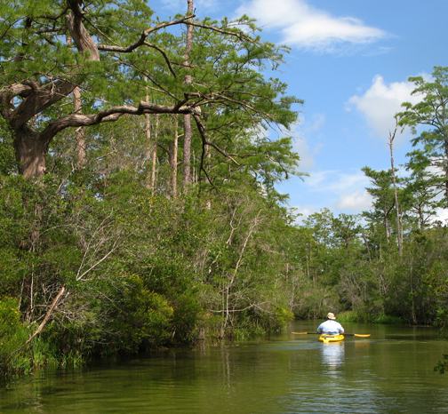
Just off of SR 85 in Niceville, Turkey Creek meanders through the Reservation offering a challenging and beautiful paddle approximately 9 miles long.
Swift and clear, the first two thirds of the paddle is tight, filled with twists and turns, and beautiful vistas as you maneuver the waterway. Trees drape over the creek, providing an abundance of shade for the first half of your journey. Native plants such as colorful St. John’s wort and pitcher plants add color along the way.
Launching from the area nicknamed the Hippie Hole, the creek eventually empties into Boggy Bayou just south of SR 20 in Valparaiso, which is just west of Niceville.
About 5 miles into the paddle, you have an option to take out at a small bridge crossing AFB Road 232. Before you get to Boggy Bayou, you will pass through the Turkey Creek Recreation area – a popular park for cooling off on a hot summer day day.
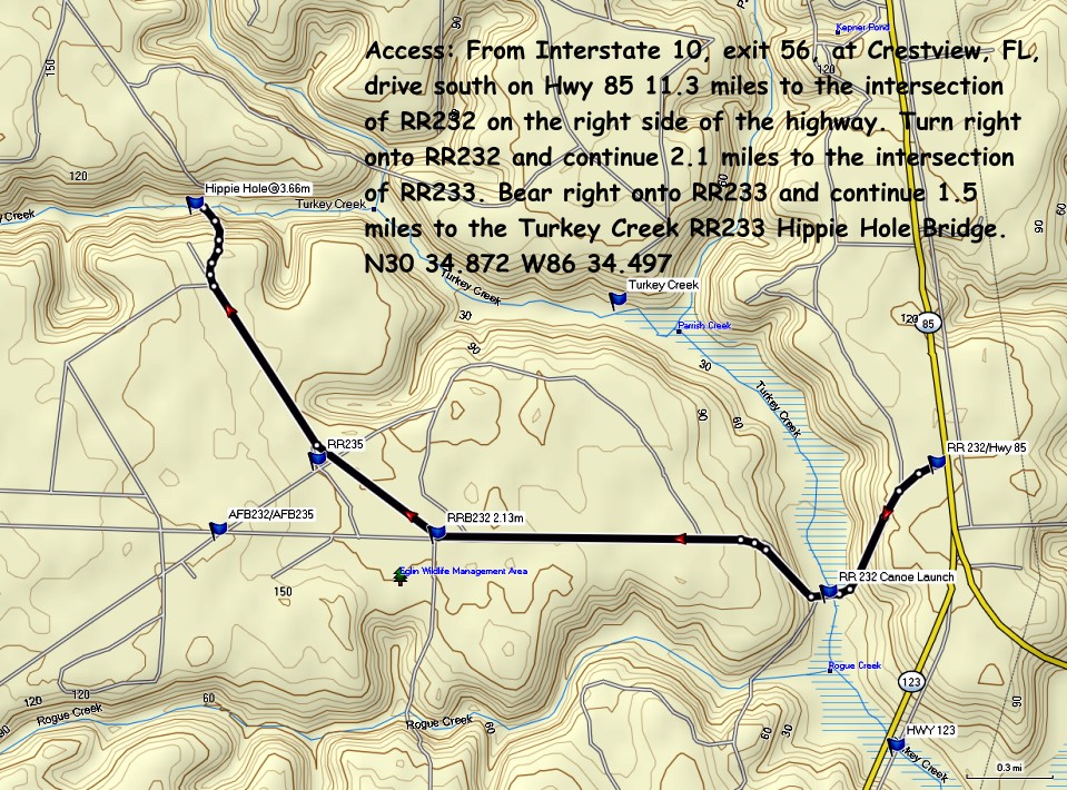
How to get there:
The put in is located on Eglin Reservation 5 miles north of Hwy. 20, in Niceville off SR 85.
I-10 Crestview Exit 56 Hwy 85 South 15 mi. Turn right 0.2 mi before 85-123 Y [N30 34.102 W86 31.773]. AFB 232 0.5 mi Canoe Launch bridge [N30 33.708 W86 32.178]. Continue 1.5 mi. Turn right AFB 233 1.5 mi to Hippie Hole bridge [N30 34.870 W86 34.473].
A good take out is on Boggy Bayou in Valparaiso at a small public park next to the cement plant on Hwy 20. ::MAP::
For information on upcoming group paddles, and join a paddling club go to: West Florida Canoe and Kayak Club.